Dartmoor’s Lost Rainforest

It was thought for a long time that the furthest south the ice reached in Britain during the Last Glacial Period was somewhere north of York. But geologists have recently discovered that the south-western peninsula was also crushed by a massive icecap - on the granite upland today known as Dartmoor. So subtle was the evidence, mostly in the form of weathered drumlins and moraines, it had been overlooked.

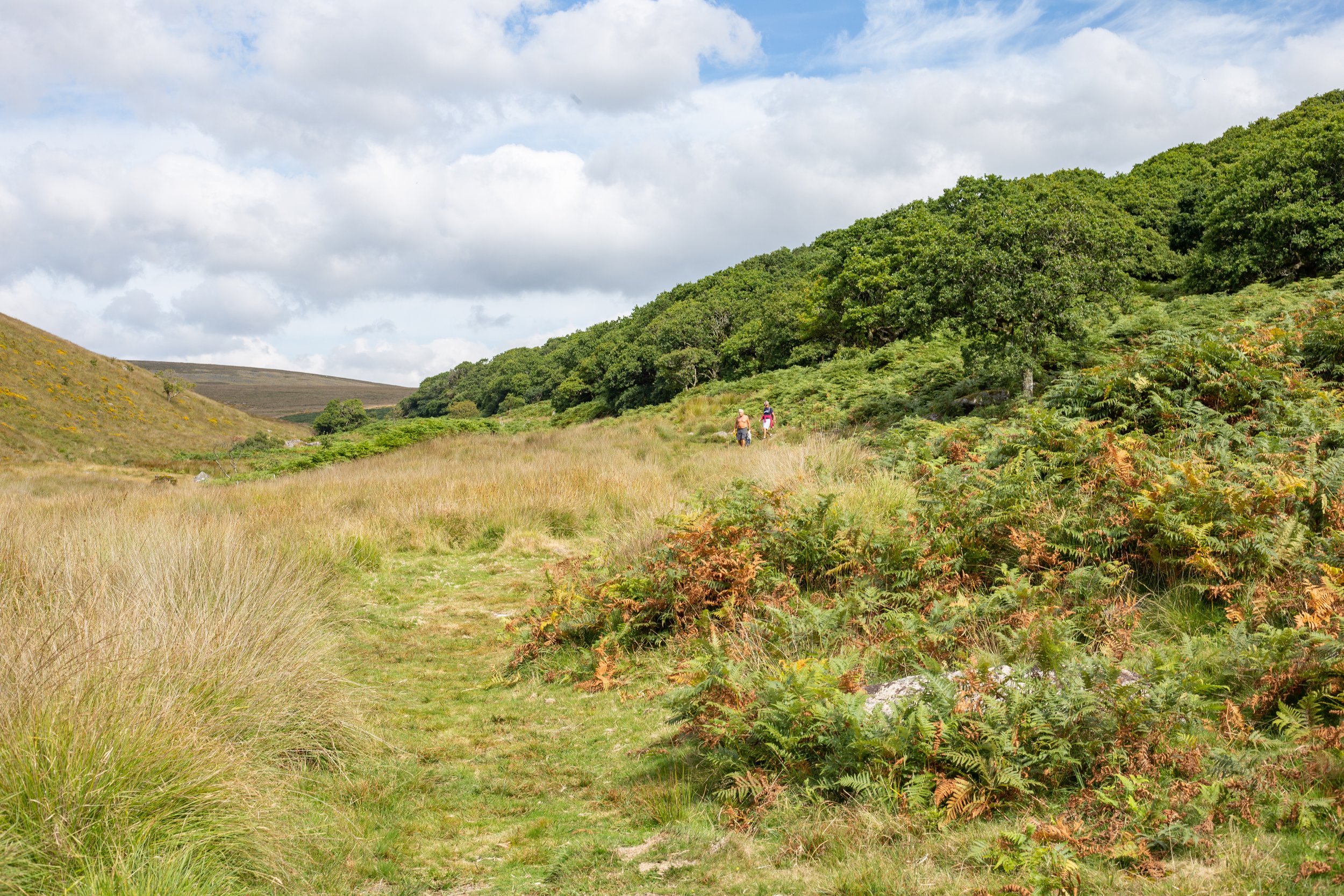
Soon after the disappearance of the ice, the area was settled once more by a riot of moisture-loving trees. Atop land once oppressed by an undifferentiated mass up to 100 metres thick, a rainforest emerged - and it endured for many thousands of years before succumbing to an intense wave of clearing by Mesolithic peoples. The Moor as we know it began to take shape. But fragments of the primeval rainforest, or at least something that evokes it, remain.

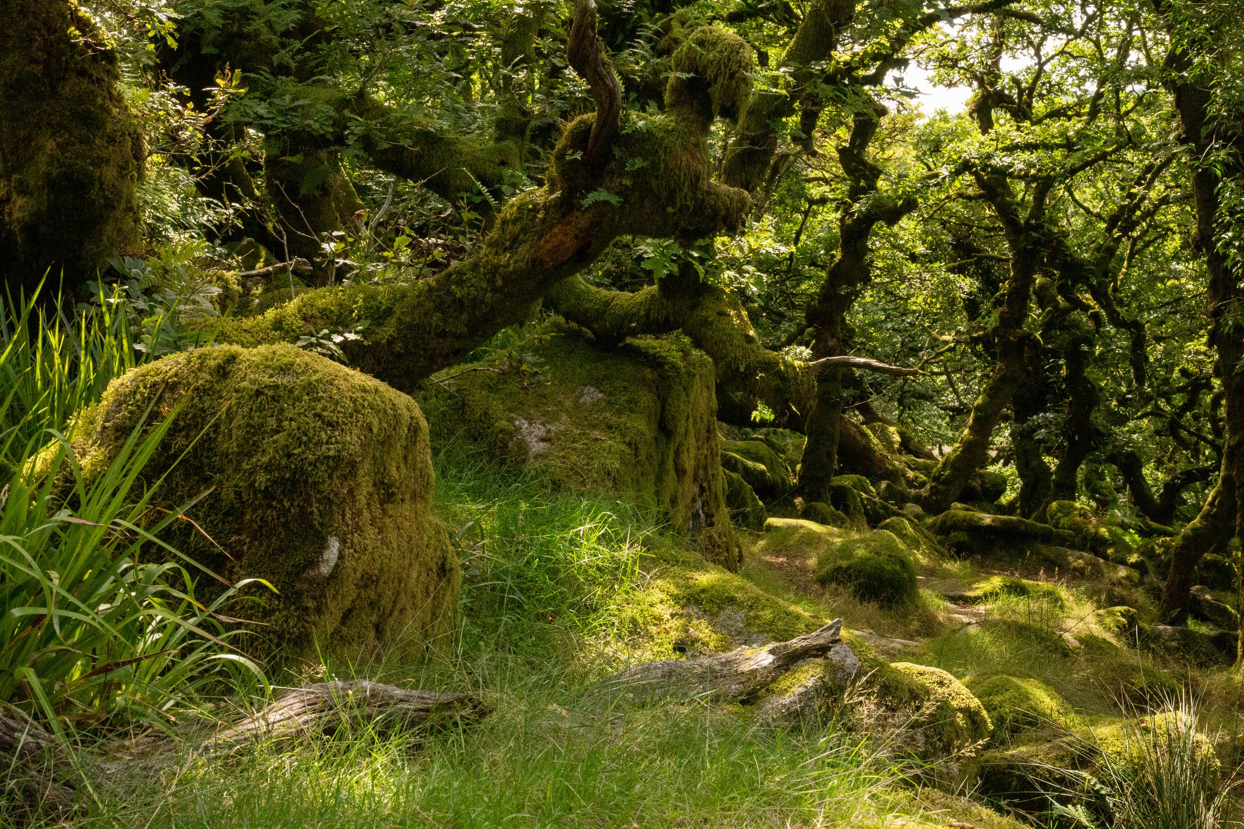
Thanks in no small part to the efforts of Guy Shrubsole, whose book The Lost Rainforests of Britain was published last year, awareness of the temperate (or ‘Celtic’) rainforest has recently surged. The conditions for this globally rare biome (modest annual temperature fluctuation and lots of rain and humidity- high ‘oceanicity’) still prevail on the Atlantic coasts of Britain and Ireland. But there are only scattered patches left, most of the primordial forest having been cleared and given over to pasture. Today on Dartmoor, the habitat is confined to a few lonely hillsides, where pistachio-green lichens cascade from wizened oaks like so many beards. What really distinguishes the temperate rainforest is the presence of epiphytes - plants that grow on other plants, including lichens, mosses and ferns.

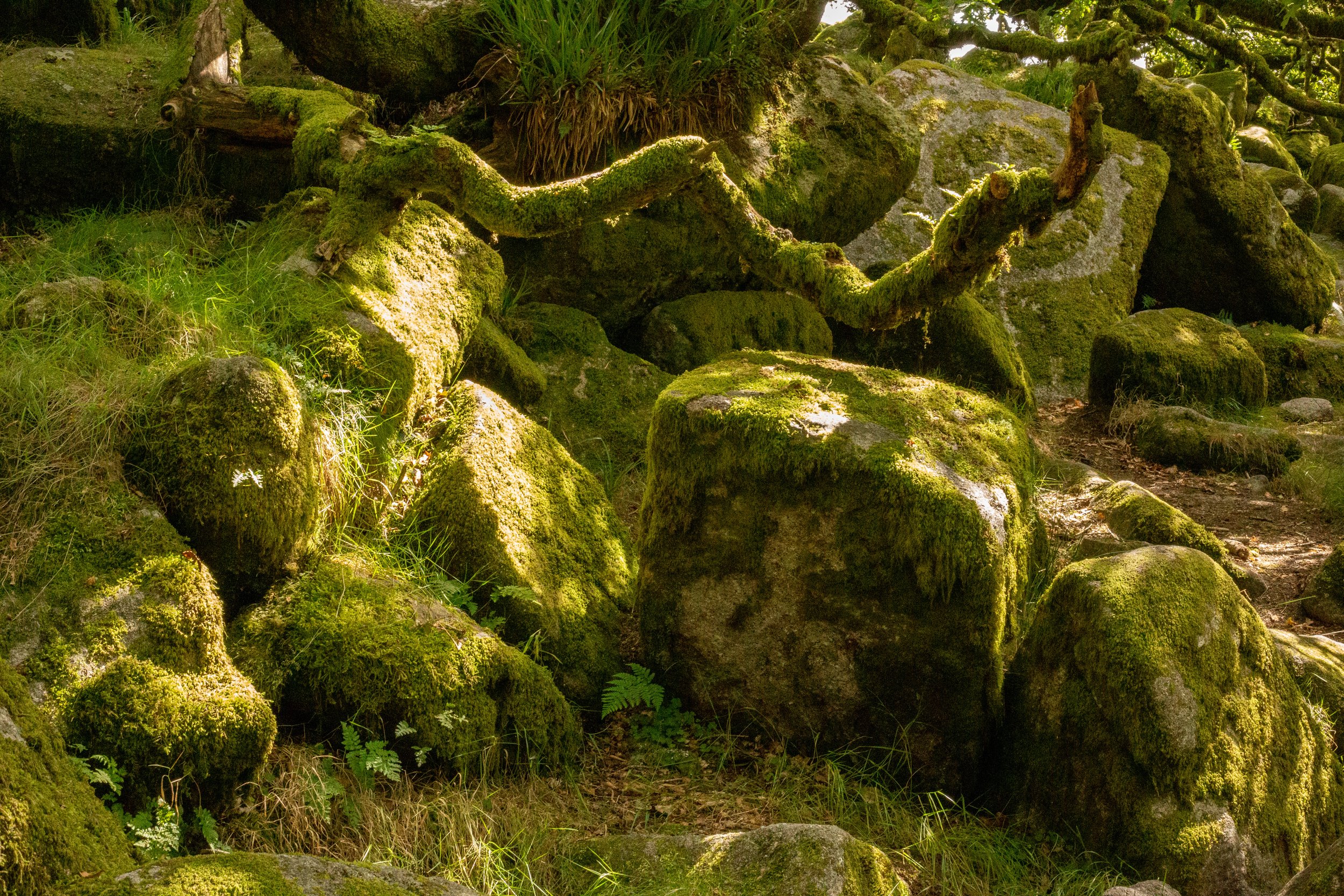
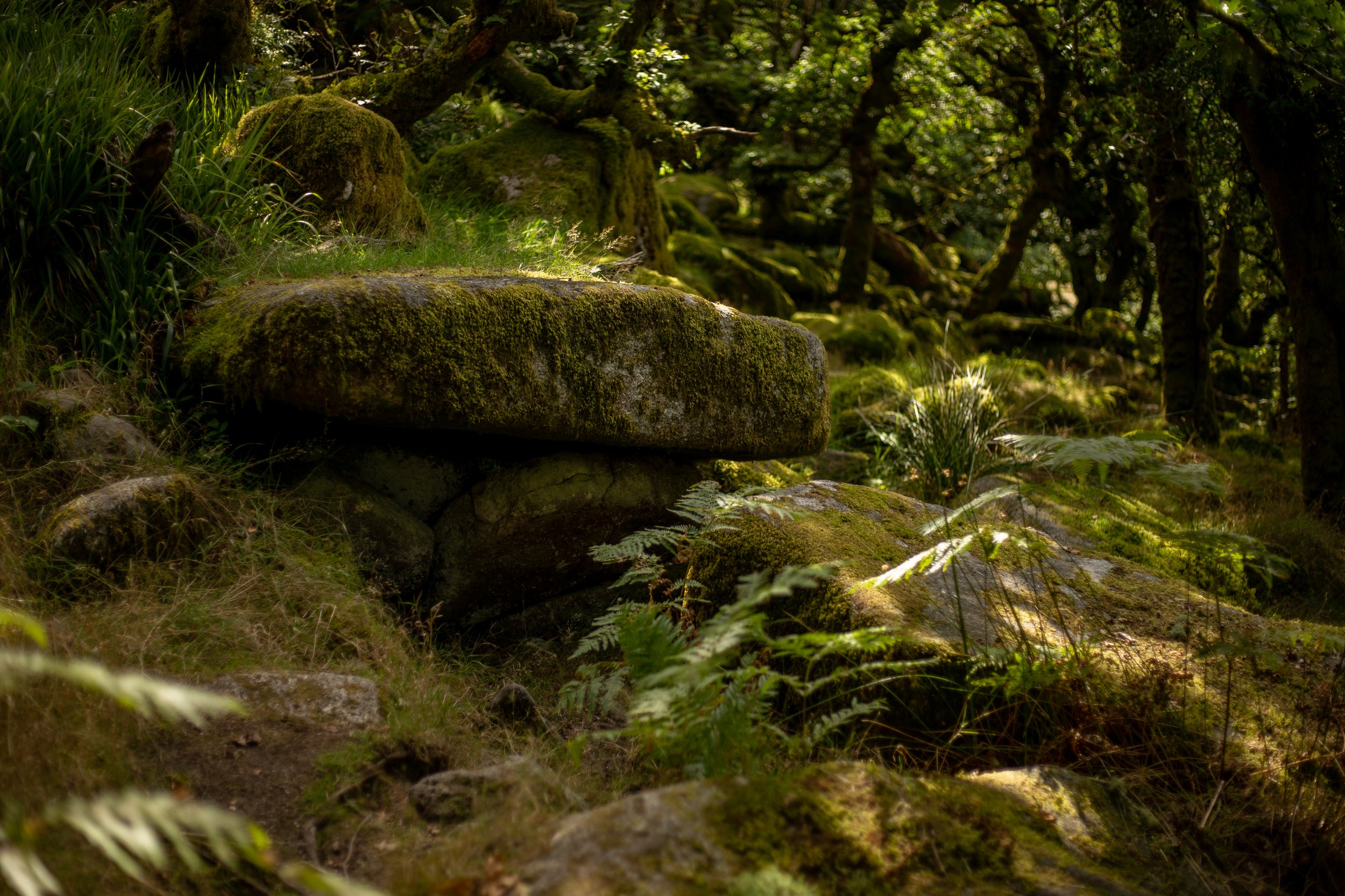
The most famous is at Wistman’s Wood in the heart of the national park. It clings to the slopes above a trickling tributary of the River Dart, and, except for the odd ash and holy, is basically a community of Common Oaks (Quercus robur), the quintessential English tree. In the normal course of things, this species can achieve heights of one hundred feet or more; but here, the tallest individuals rarely surpass fifteen. The Wood is what anthropologist Eduardo Kohn calls a ‘dense thicket of life.’ Every tree is bedecked with other plants, and the boulders strewn amongst them are covered in luminous emerald mosses. The presence of this ‘clitter’ (or collection of stones) has often been cited as the reason for the Wood’s endurance against the odds, preventing grazing.

Scrambling off the Moor and into the dappled gloom felt truly like passing through some kind of portal. I was enthralled by the place, its inexpressible sense of mystery and antiquity. The stillness. Like so many others, I had the feeling that the Wood was enchanted, imbued with an unknown significance. For as long as I stayed, the whole world felt - in a way never possible in cities - steeped in symbolism.

Looking back, it’s clear to me that this feeling was engendered, at least in part, by the visual language of fairytales. Early exposure to Brothers Grimm tropes, through bedtime books and Disney animations, cultivated deeply-rooted associations. And yet it’s also possible that these very motifs - gloomy oak-woods, intertwining branches, speckled fungi - reflect or express something buried in our psyches. A longing, perhaps, for a prelapsarian state, a return to the Wildwood.

Losing myself in ambient music, I sat on a boulder and reflected, trying to figure out how and why the Wood was affecting me. In this place, no particular effort was needed to be present. I stopped caring about the time, and allowed myself to experience the flow of things. At a certain moment, however, I also became aware of a certain desire to know things. Part of me wanted, essentially, scientific information about the Wood, to know something of its natural history, its ecological entanglements. Despite myself, I couldn’t be satisfied with naive observation and attunement. There was no urge to start Googling there and then, and it probably wouldn’t have been possible anyway, but I made a mental note to find out more once I’d returned to normal life.

For Max Weber, it was precisely the pervasiveness of this assumption that indicated a disenchanted world: the internalised expectation that, if we wish to find something out, we can in principle do so. We know that there will be an explanation ready to hand, written in a register by which the denizens of the forest figure as biota or symbionts. This ‘epistemic confidence’ can be considered one aspect of a worldview by which the Earth is ‘revealed’ to us as standing reserve. Such an attitude is starkly dramatised five miles down the road at the Bellever forest, the antithesis of the hold-out copse, which serves as a useful reminder that the great majority of trees on Dartmoor are grown for profit.

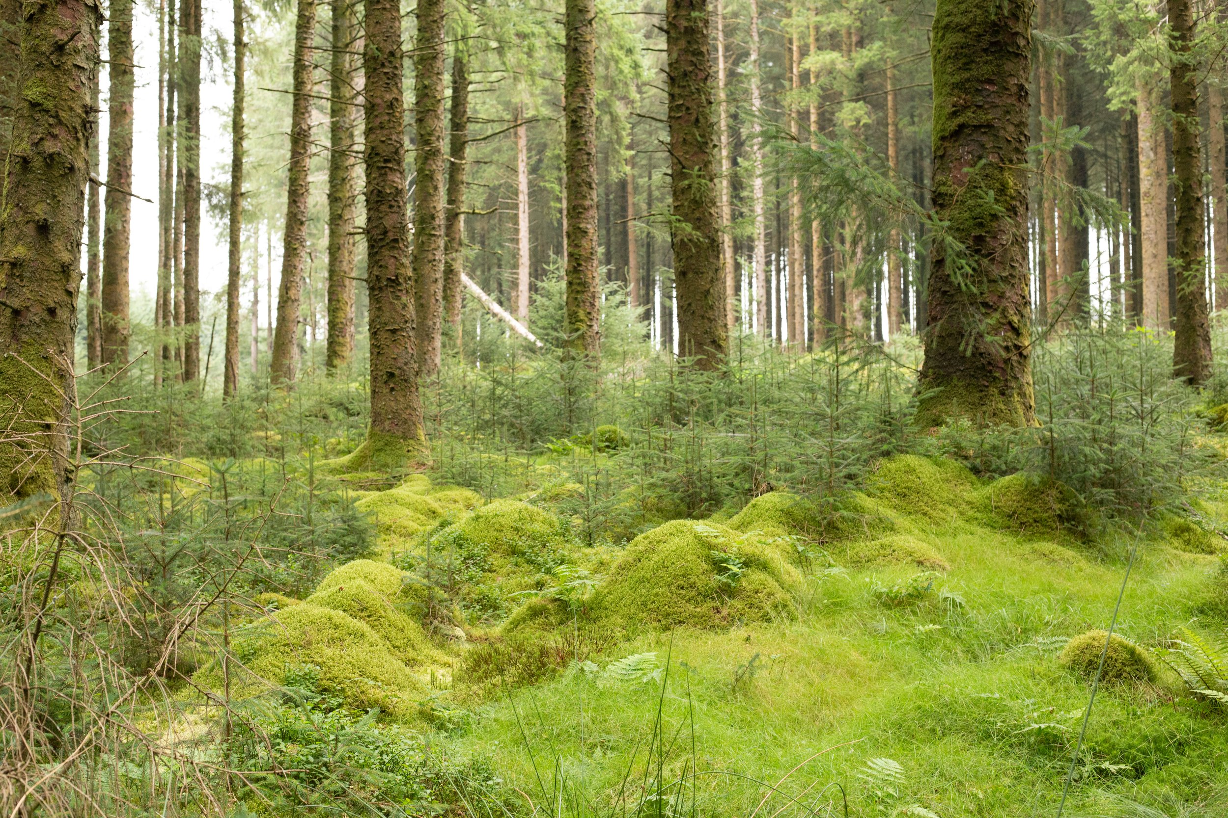
There are four large conifer plantations on the Moor of mostly Sitka spruce (Picea sitchensis), a species native to the Pacific north-west that can reach heights of almost 100 metres. After the last great thaw, it was one of the first trees to establish itself in the glacial moraines and foggy fjords of Alaska and British Columbia. But now here it finds itself in densely regimented stands on a remote peninsular highland, a continent and an ocean away.

The plantations were mostly laid down in the aftermath of the First World War, during which swathes of British forests were felled to line the trenches of the Western Front. Amidst fears of a global timber famine, the Liberal government set up a committee to assess the role of afforestation to postwar reconstruction. Its recommendations led to the founding of the Forestry Commission in 1919, whose central task was to secure timber supplies. But it was also hoped that the new forests would help reinvigorate rural communities in upland areas. For this reason, most of the moorland identified as suitable for planting was close to manufacturing centres and coal fields, making Dartmoor a relatively minor player in the overall scheme.

But as Matthew Kelly recounts in Quartz and Feldspar, it had a landlord keen to be seen to act in the national interest, the Duchy of Cornwall, which swiftly set about planting Brimpts and Fernworthy farms. Responsibility for the plantations was later transferred to the Forestry Commission, however, after officials found a ‘very lax…regime’ during a 1930 inspection - with forestry seemingly subservient to sport.

The Commission also had to contend with the Dartmoor Preservationist Association, which opposed the plantations on the basis that they compromised the Moor’s desolate beauty by blunting the profile of hills and, in the case of Bellever, on account of various antiquities - cairns, hut circles and evidence of an early field system. In the end, the development went ahead, creating the second-largest plantation on the Moor. But not without significant concessions to the preservationists: the antiquities were left uncovered and access to Bellever tor preserved.

It still provides a good vantage point from which to observe the landscape mosaic. Dartmoor is composed of numerous ‘patches’, a term used by landscape ecologists to signify distinct areas of habitat differing from their surroundings. The vast open moorland is interspersed with sheltered valleys and small plots of enclosed farmland, alongside the fragments of temperate rainforest and the plantations.

View from Bellever Tor over Dartmoor. It’s only when you climb up and look out over the landscape that the contrivance of the plantation really hits: sharp edges and clear-cut wastelands.

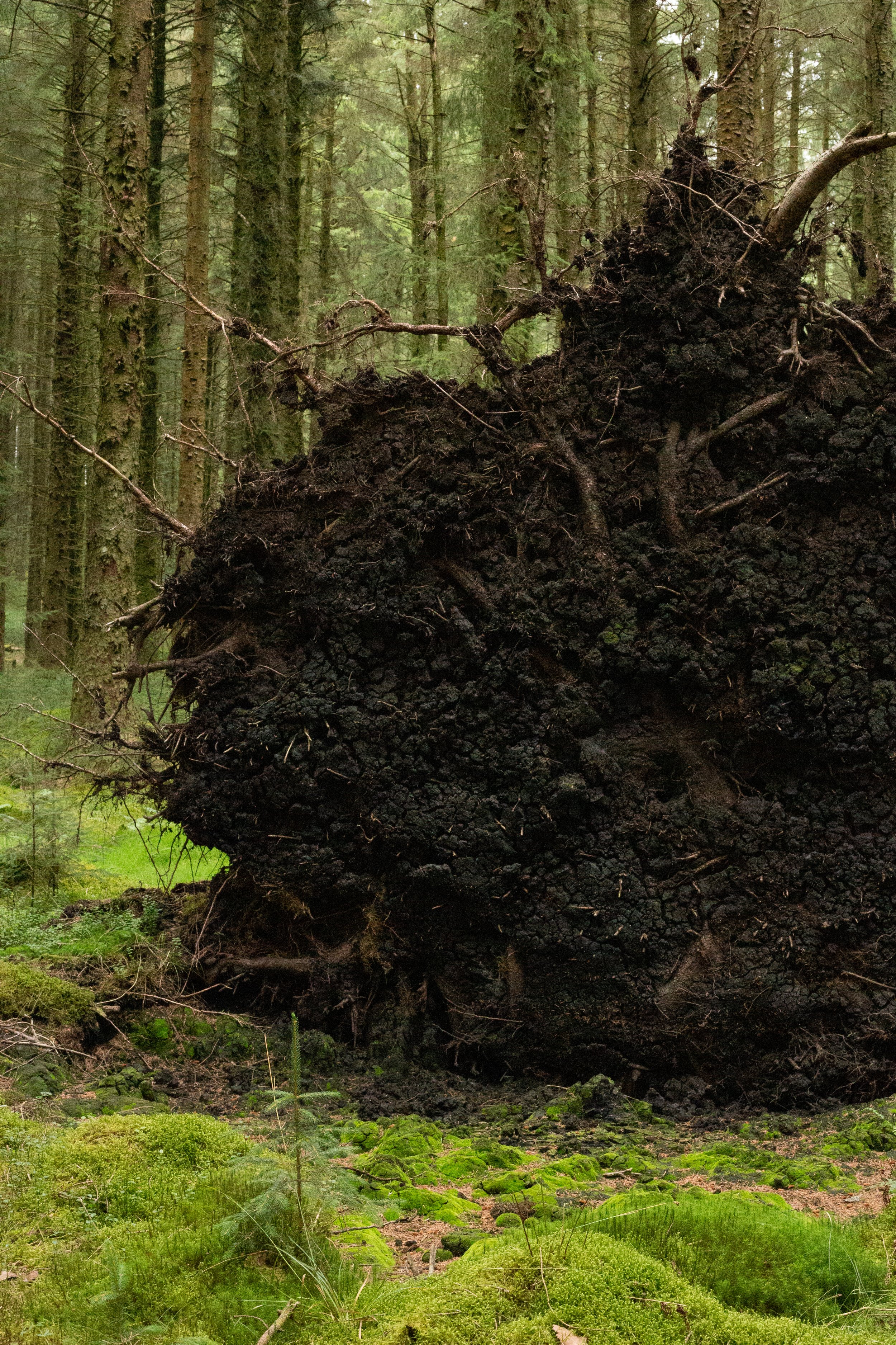
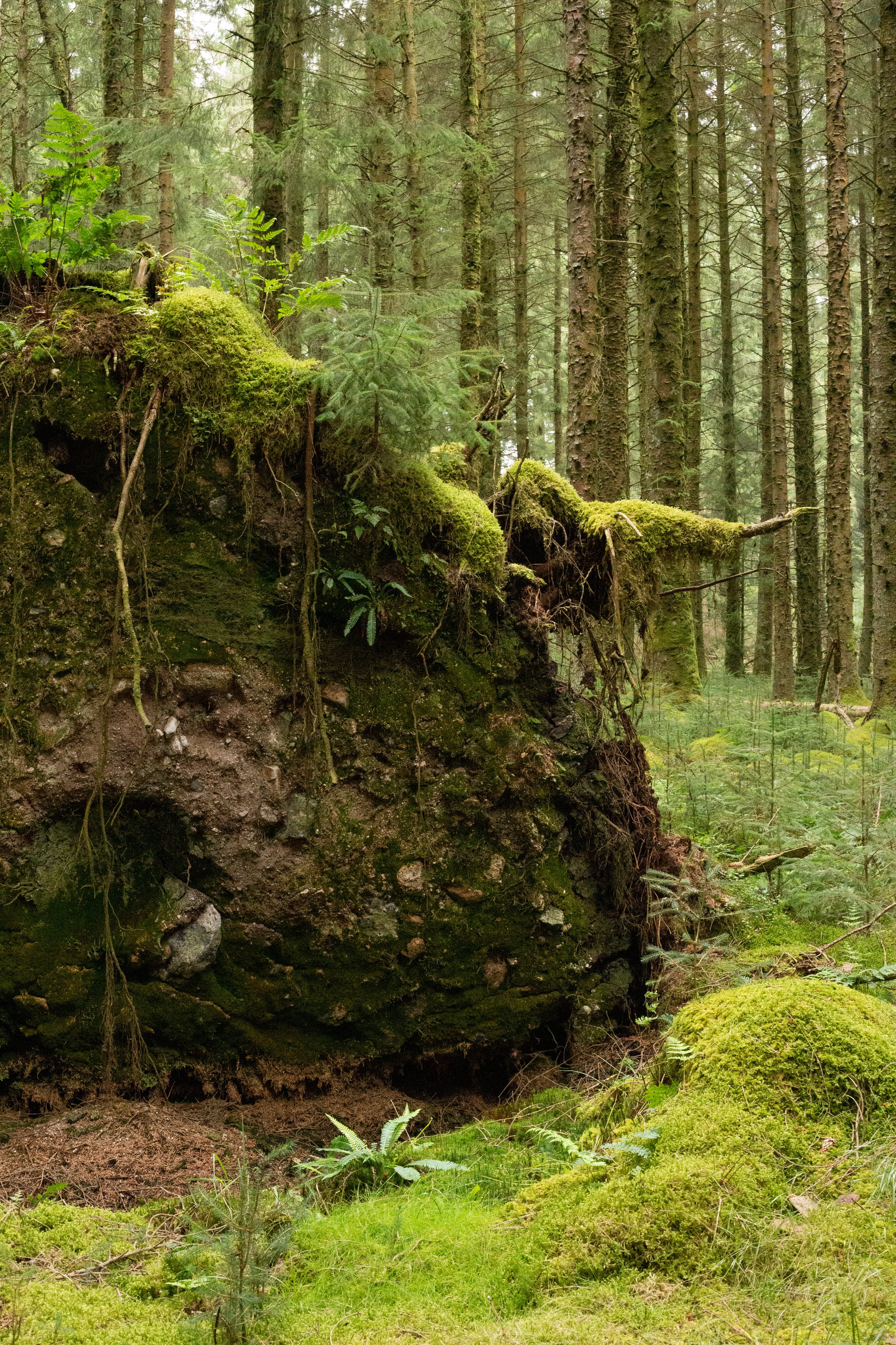
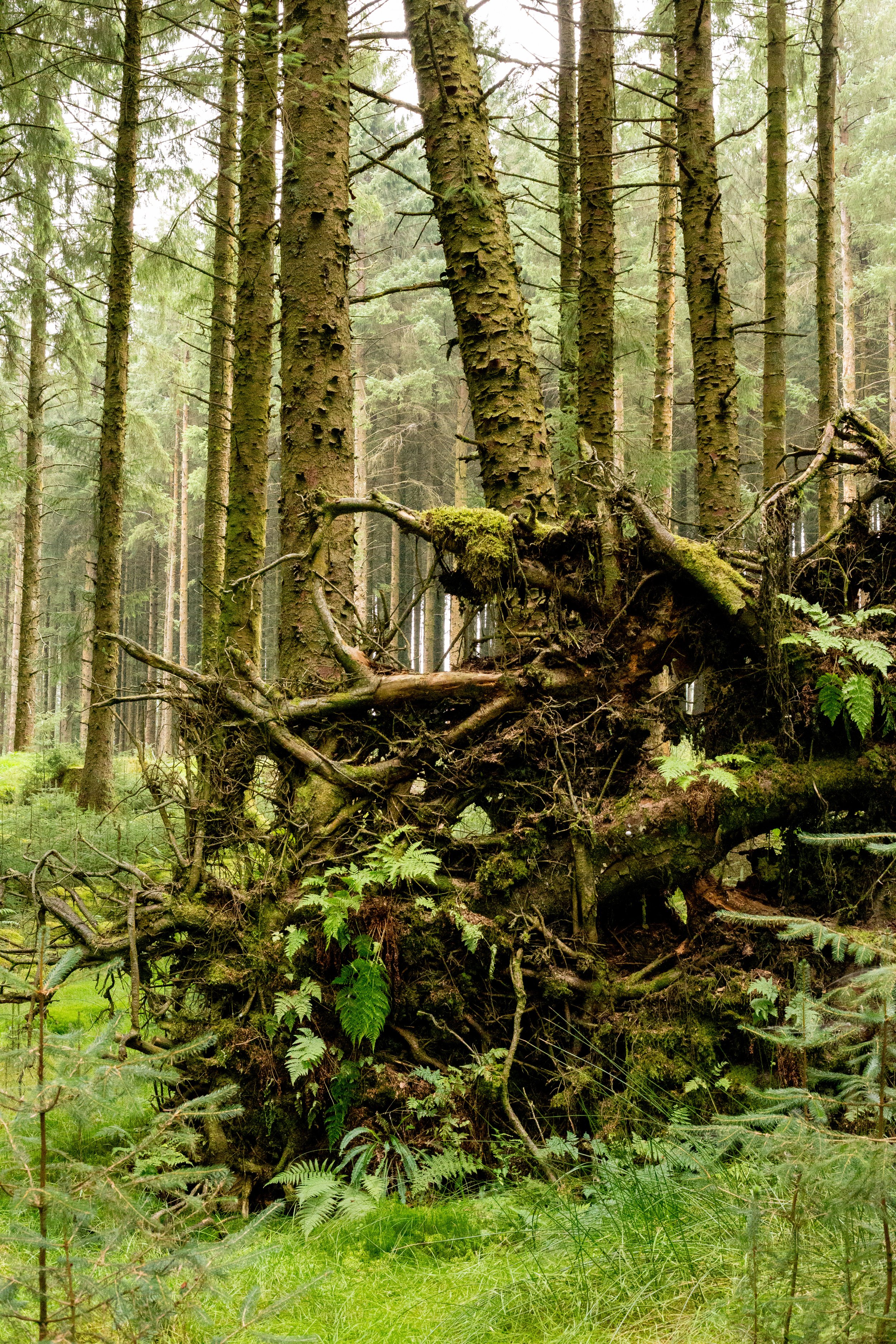
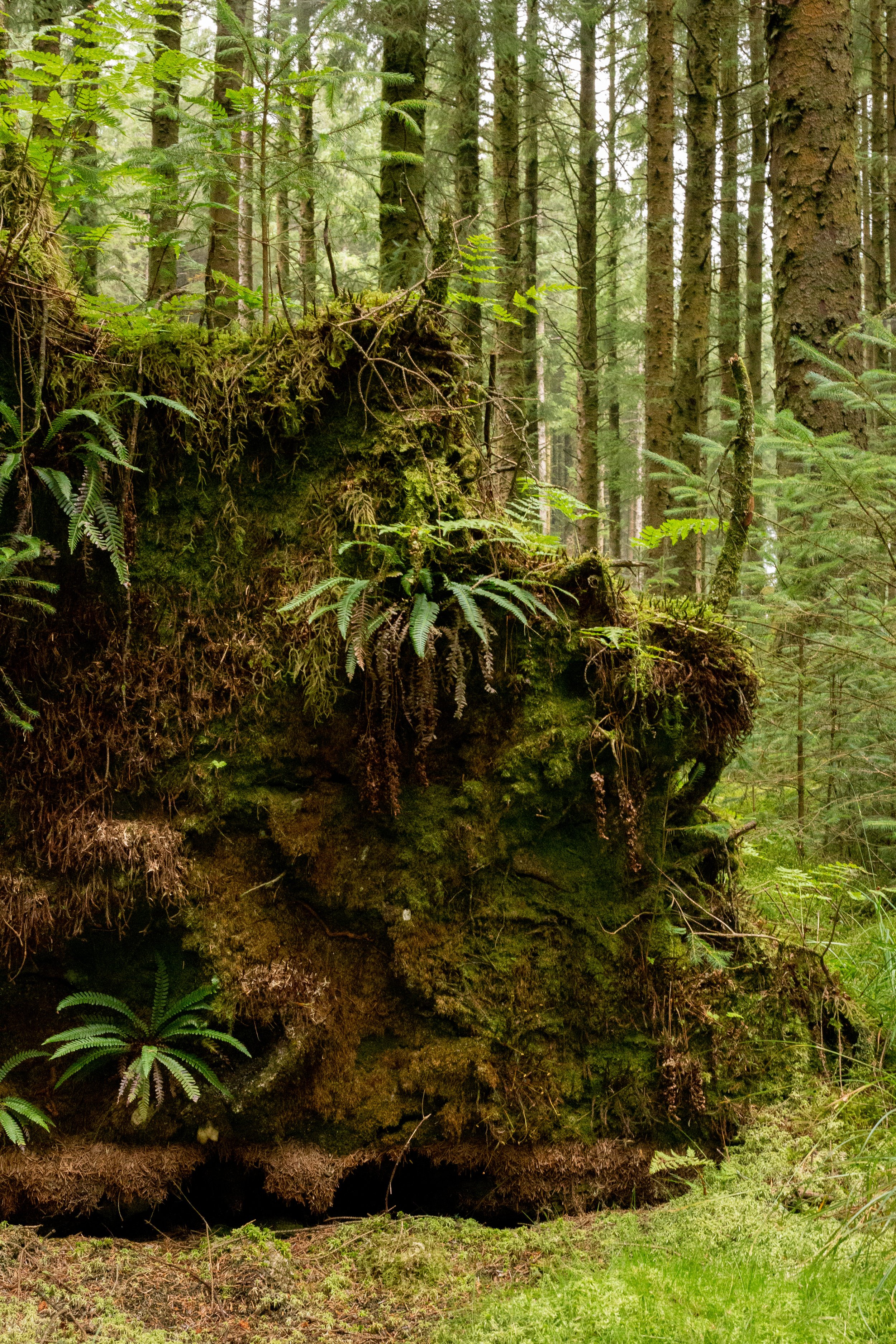
Back amongst the trees, I took a detour off-track to examine a fallen spruce, resting atop a mattress of moss. It had clearly been there for quite a while: the haphazard roots, ripped from their sheltered dwelling, had acquired a green tinge, and there was no sign of a cavity at the base. Spruce tend to have quite shallow root systems, making them vulnerable to high winds. And wandering around the immediate area, I came across many other casualties, each at differing stages of integration with the forest floor. Prematurely felled by forces of nature. I remember being struck by the insouciance by which the corpses slowly decayed into humus and returned to the soil from which they came. The casualties do not jeopardise the overall viability of the plantation, and so, seemingly, are just left to be reclaimed.

While wandering around, I became fascinated by the variations in tone and texture of the bases: the fresh, vivid soil of the newly fallen, through to the dry, green-tinted faces of the partially reclaimed. The longer the repose, the more epiphytic ornamentation: bright garnishes of ferns and mosses - even the odd spruce sapling, daringly trying to establish itself on a precipice. This speaks to one of plantations’ strangest qualities: they are organised around the extreme manipulation of nature, but simultaneously teem with an abundance of life. No more so than in managed forests, where, at least relative to other plantation types, there’s a sense of disorder. After all, the product is timber. It doesn’t have to be coaxed into expressing pleasing tastes.

But it’s not possible to trick yourself here, to forget that this is a commercial forest managed according to a masterplan, its vitals constantly monitored - ‘a machine of replication’, in the words of Anna Tsing. The plantation was compelling in its own way, but couldn’t come close to inducing the same feelings of peace and transcendence I’d experienced the previous morning at Wistman’s Wood.

And yet, as I cycled back to Exeter later that afternoon to catch the London train, it struck me that without the late-summer serenity of the day, the last of August, which bestowed on the place a dappled perfection, my response to the Wood would surely have been different. I later caught a glimpse of its dark side in John Fowles’ poetic description of a solitary winter expedition there in 1946. It appeared to him a bad place, not somewhere to linger: ‘forlorn, skeletal, almost malevolent’. With such an image in mind, it makes more sense, perhaps, that our ancestors felt moved to strip the hills so thoroughly, with fire and axe, of their vegetation.

The boundary between open moorland and Wistman’s Wood.


Planetary Dreams: a critique of Google Earth

‘Nothing can remain immense if it can be measured.’

Hannah Arendt, The Human Condition (1958)

Hannah Arendt’s words have particular poignance for an age in which the entire planet has been measured, mapped and simulated. We know the contours of every island, their relative size, the depth of every lake, even the rough trajectory of continental drift. Within two-hundred million years, the familiar landmasses will have crunched back together again to form a new supercontinent: Pangaea Proxima.

Such thinking is so deeply naturalised that psychologists and geographers speak of perceptually salient features being copied into the mind like a map (the ‘cognitive’ approach to orientation). Against this, an anthropological approach emphasises that places do not so much have locations as histories. People do not ‘navigate’, but wayfind. Without the map, the world has no contour, form, or limits. It is just the world. 

This idea is something alien to us moderns, so entrapped in a mode of thought which separates humans from ‘nature’, subject from object. With our capacity for ‘whole earth observation’, epitomised by the famous Blue Marble image, the world has been shrunk into a ball, its basic contours as familiar as an iconic logo. Google Earth is one of the most significant products of such dualist thinking; an intensification of its analogue antecedents: physical globes by which continents are mapped perspectively onto a spherical surface made variously from hides, papers and plastics.

But while the latter are inherently ‘global’ in Dipesh Chakrabarty’s (2021) sense (humanist; encompassing histories of state consolidation, dialectics of empire and capitalism), the former aspires on a fundamental level to embody the ‘planetary’ - a category which decentres humans. However, this objective cannot be reached and will remain forever elusive. Google Earth can be seen as a fetish object, the psychological equivalent of a synecdoche, by which a part (the idealised surface) is made to represent the whole: Gaia.

This is crucial in the age of the Anthropocene. Not only were humans never separate from nature, it is becoming increasingly difficult to clearly differentiate so-called natural shocks from the symptoms of ‘our’ cumulative actions. Such circumstances have profound implications. And there is a wealth of literature in anthropology, philosophy, science studies addressing them, much of which concludes with a clear imperative: to overcome dualism, cultivate climate-thinking, ecological awareness, planetary social thought and so on.

I want to suggest that Google Earth hinders such awareness, both through its fundamental architecture and more granular properties, by reproducing tendencies towards calculation, oversight and objectification. As a product of one of the world’s most powerful monopolies, the originator of ‘surveillance capitalism’, the program should be regarded with critical scrutiny by default. This is all the more important given the unique success of Google’s public relations strategy. The name is something almost magical, inscribed into the symbolic order as an essential public service in a way that necessarily obfuscates the underlying business model, which returns extraordinary profits. 

But my purpose is not so much to critique Google Earth as such, to somehow unveil its pernicious ideological mystifications. Rather, I explore how it exemplifies a condition by which we have lost control of our tools, cast adrift without a compass in a world we thought we had mastered. Google Earth is a product of the ideological condition particular to postmodern culture, whereby there is no Logos (God, History etc) to guide us. It protects us from the traumatic Real of our time: that we are sleepwalking into the abyss, in thrall to the logic of enframing, with no map to show us the way out. 

Regimes of historicity: the global and the planetary

Since Google Earth emanates from servers as binary code, beamed to computers all around the world, it therefore ‘exists' in potentially infinite forms at all times. We know then that we are dealing with something very different when Google promotes the program as the ‘the world’s most detailed globe’. Striking in this slogan is the proximity of the three terms (Earth, world and globe), whose meaning it takes for granted. Although used interchangeably and inconsistently in everyday speech, it is worth interrogating these terms. Taken too far, each collapses under the weight of conflicting interpretations.

With respect to ‘globe’ and ‘planet’ (the conspicuously absent term in Google’s formula), an illuminating discussion is found in the work of Dipesh Chakrabarty. His latest book, The Climate of History in a Planetary Age (2021) extends the ideas sketched in ‘Four Theses’ (2009), a seminal intervention in the Anthropocene debate. Reckoning with what Isabelle Stengers calls the ‘intrusion of Gaia into the horizon of human history’ collapses the old distinction between natural and human histories and so requires us to bring recorded and deep time together in our analyses of the predicament and all that led to it. Chakrabarty argues that this means thinking in two ‘distinct registers’ at the same time: planetary and global. 

The former is the aggregate outcome of Earth system science, which foregrounds the march of epochs - successive chemical, biological and geological configurations, each giving way under pressure from various shocks, exogenous and not. Chakrabarty’s other category, by contrast, has emerged over centuries through the work of humanist and social-science historians. The ‘global’ is essentially the story of how the Earth as indifferent natural object-realm was converted into a sphere of action for humans, an interconnected global space inseparable from the logics of empire, capitalism and technology. These two ‘regimes of historicity’ operate on radically different timescales.

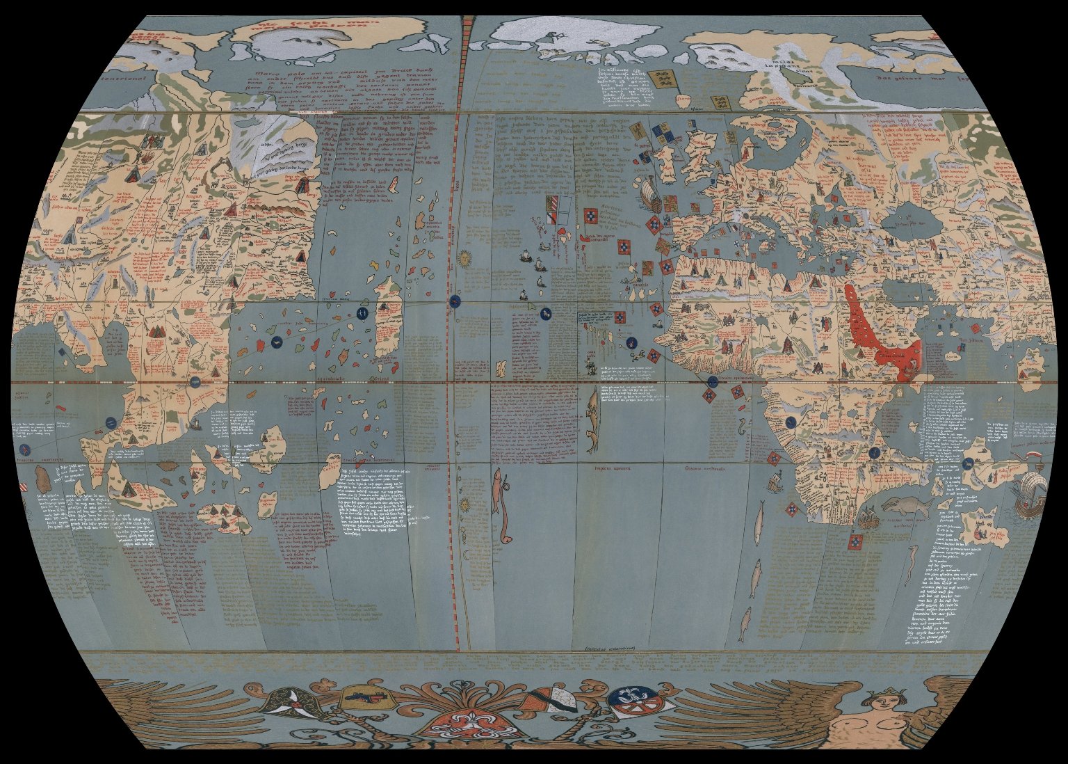
Martin Behaim’s Erdapfel (1492)

Globes in the traditional sense are both productive of and produced by the global regime of historicity in Chakrabarty’s sense, encapsulating the human need to find and stabilise our place in the cosmos. When viewing pictures of historic globes in succession (cf. Sumira, 2014), the viewer is struck by the diversity of idiosyncrasies and mysterious embellishments: whirlpools, hideous sea monsters and personified winds. The oldest surviving example, Martin Behaim’s Erdapfel (1490-92) displays a vast empty ocean between Europe and Asia (Columbus did not return to Spain until 1493), as well as the mythical Saint Brendan’s Island in the North Atlantic. These are products of profoundly different worldviews; mythological and religious thinking. We are left with a scattered material history of fallibility, explicitly provisional and, from our perspective, ultimately failed efforts to map the world.

How does Google Earth fit into Chakrabarty’s paradigm? Only on a first approach should it be read as an outcome of the planetary regime of historicity. Certainly, it represents some kind of culmination of Earth System Science: an assemblage of vast volumes of scientific data generated through various forms of Earth observation particular to industrial modernity, geophysics, geochemistry, geological surveying, ground sensor networks and, above all, satellites. When viewed without superimposed borders, the simulation decentres humans. However, as the next section explores, it is innately ideological.  And so, in the final analysis, it falls back into the domain of the global, though in a disavowed, paradoxical manner.

‘I know very well but still’: Google Earth as fetish object  

Like all slogans, Google Earth’s cannot stand too much scrutiny. But its central claim nevertheless holds true: the program is the most detailed representation of the planet ever created. Or at least for the inhabited, man-altered surface. All that lies beyond, in the depths of the underlands, the vastness of the oceans, are ignored or inaccessible. The immersive photo-sphere is stitched together from countless satellite images using a technique known us ‘clip mapping’, by which only small regions of graphics - the local area under examination - are displayed in high resolution. This makes possible algorithmic sorting, the selection of relevant data from an otherwise unmanageable volume. 

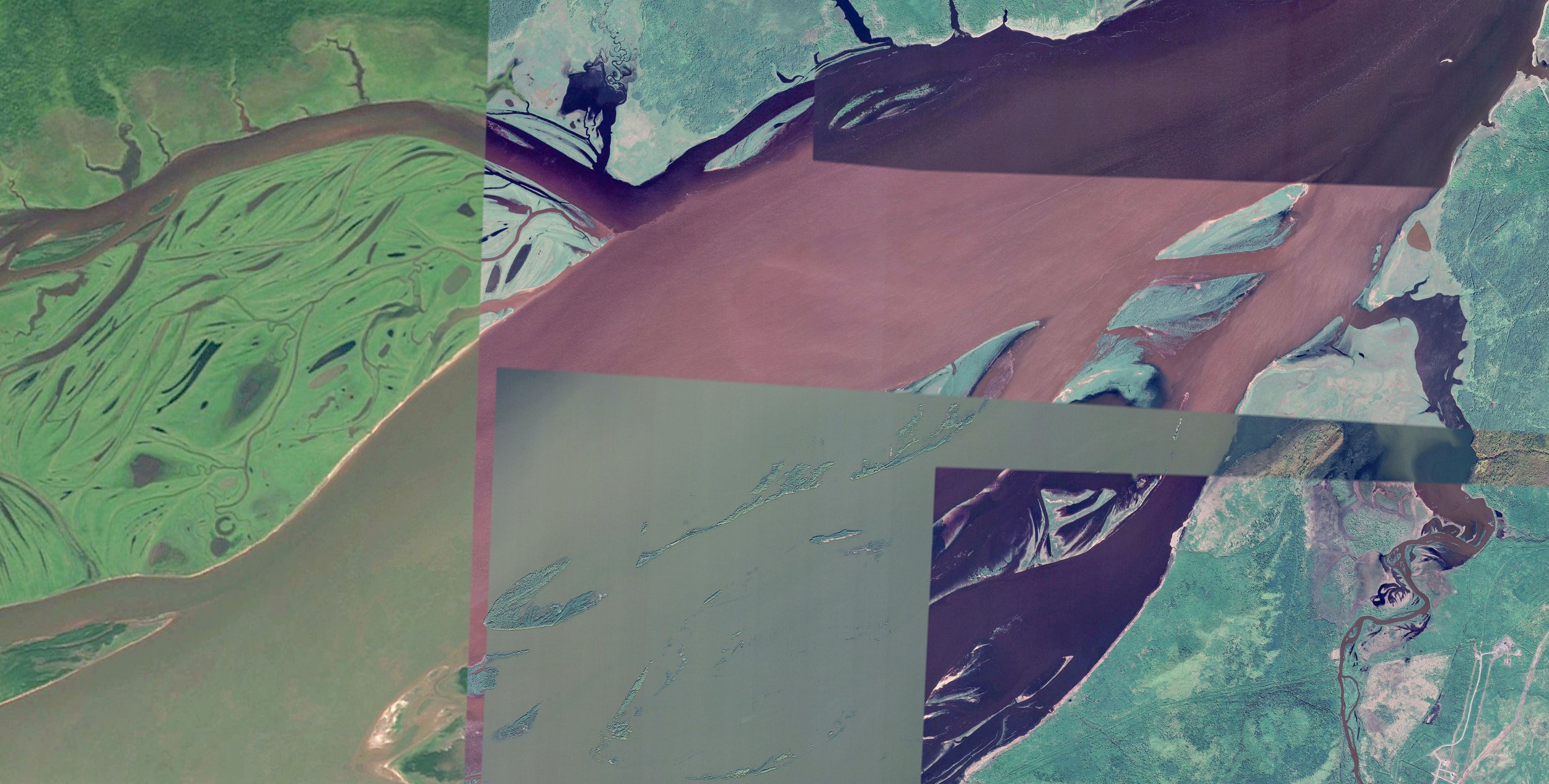
This process of ongoing self-resolution can be apprehended when zooming in or out: once the user stops navigating and the target location is inferred, the continual flustering of pixels is stabilised at a given distance. This is a world unfolding, fixed for contemplation. But it can be reanimated at will, as the user approaches new levels and planes of perspective. Sometimes, wholly contrasting time sets of images are encountered side-by-side: a patchwork of overlapping seasons, bisected by an intrusive mathematical line. Naked, blasted skeletons on one side; a forest of virulent trees on the other. This is the result of data dynamism, and the effect is to dispel any illusion of ‘visual nominalism’ that might prevail. Such failures are an encounter with the Real of the technology - its inherent bittiness. 

Viewed from a different angle, the outward expression of clip-mapping in in some sense a technological equivalent to our experience of reality according to the post-Kantian orthodoxy (‘correlationism’, to use Quentin Meillassoux’s term). As humans sense the world, by way of the categories, the brain interprets in a contingent way: what we get is not the Thing-in-itself. As Deleuze put it, consciousness is just a dream while awake. Google Earth in this sense is like a steam-age Mental Processing Unit, not yet sophisticated enough to display phenomena without consciousness apprehending their inherent bitty weirdness, but rather a composite of different sensual ‘feeds’, the result of all manner of technologies (the ‘senses’ of industrial civilisation) and reliant on an extensive infrastructure for its existence: transatlantic cables, datas centres and so on. There is not yet an illusion of immediacy; the simulation fails insofar as it appears mediated. 

The significance of the simulation’s failure should not be underestimated. Even though the user cannot avoid apprehension of the program’s basic deception (that this is an indexical representation), we nevertheless act as though it is. The power of Google Earth resides in its representative properties; what awes us is that this is the world in its entirety, all that is known and knowable. Such an attitude is what psychoanalytic theory calls ‘fetishistic disavowal’ -  central to any understanding of ideology today.

Google Earth ultimately relies on a series of mystifications which are both symptoms of postmodern scepticism and a precondition for the continuation of global civilisation. 

First, it reflects actually-existing power relations. Even a powerful entity like Google must make decisions about which regions to prioritise with the latest and most high-definition imagery. It has stated that the key factor is population density, but it is practically inconceivable that relative importance to the global economy does not play a part.

These imbalances are especially acute when it comes to the 3D mapping: a 2018 blogpost announcing the latest updates did not feature a single city in the Global South and only one, Tunis, in Africa. This proposition that certain cities matter more to the established global system is not controversial. And yet the effect is to reproduce naturalised notions about which areas of the world matter: invariably the core, the former metropoles. 

But this is perhaps less significant factor than the God’s-eye perspective inherent to Google Earth. Such a perspective impresses on us the true scale of the planet, allowing us to grasp long-haul flights and transcontinental journeys. The vastness of the Pacific. But this is a disengaged view from nowhere and, indeed, satellite imagery can be conceived as the emblematic technology of ‘mastery over the planet and of abstraction from any place on it’.

At one extreme of the zoom, the planet resolves into a small, luminous orb suspended in the centre of our screens against a backdrop of the Milky Way. The sense is almost pre-Copernican, theistic - but a the same time, decidedly Cartesian: it can be sent spinning at the click of a mouse. The subject acts decisively on the object, which figures as an entity primed for geoengineering. 

This links to a further ‘affordance’ which recalls Arendt’s observation (1958) that it was ‘precisely when the immensity of available space on earth was discovered’ that the shrinkage of the globe began. There are no more terrestrial frontiers or mysteries of the horizon, tales of unknown shores and spectral landmasses.

The original whole earth image, Blue Marble, inspires appreciation of fragility - gratitude, humility. But the (global) history of humanity has been driven by very different impulses: exploration, conquest and brutal subjugation. And once everything on Earth has been measured, this attitude is just displaced onto the cosmos itself. No phenomenon is more indicative that the accelerating ‘billionaire space race’. 

To aspiring world-historical figures such as Elon Musk and Jeff Bezos, the finitude of Google Earth is a frustration and a call to arms. The ongoing mapping of the Moon and Mars is a precursor to making of them staging posts in the quest to make humans a multi-planet species. These entrepreneurs are the would-be Pizarros of the twenty-first century; except rather than in thrall to the patronage of monarchs, it is governments, to the contrary, that rely increasingly on their private industrial apparatuses for space services.

And it is to these titans to whom millions look for hope: their grand visions promote faith in coming technological salvation, which is figured as always just around the corner: from self-driving cars and carbon capture through to Neuralink and the terraforming of exoplanets. But in calling for colonisation of other celestial bodies (worlds made for humans by humans) rather than directing all resources to mitigating catastrophe at home, they evince a kind of nihilism particular to advanced capitalism.

Beyond the obfuscatory nature of the program’s fundamental architecture, the more granular can also be steeped in dualistic thought - even when the professed purpose is to promote climate awareness. In 2021, for instance, Google Earth announced a major update to the software: a time-lapse feature that enables users to ‘take a step back’ by sliding between thirty-seven years of satellite imagery. As director Rebecca Moore put it in a blogpost: 

‘With Timelapse in Google Earth, we have a clearer picture of our changing planet right at our fingertips — one that shows not just problems but also solutions, as well as mesmerisingly beautiful natural phenomena that unfold over decades.’

Among a set of features on the lauded ‘solutions’ was an invitation to ‘meet’ the Suruí people’ of Mato Grosso, Brazil, with whom Google Earth (under the auspices of Engine and Outreach, two of Moore’s initiatives) has been collaborating since 2009 to combat illegal logging. This partnership, bringing together computing might and indigenous knowledge, is a striking example of how the program can be used for practical ends.

On first seeing a satellite image of his homeland, Google informs us, the tribe’s leader, Chief Almir, was immediately struck by its power to ‘convey the importance of his tribe’s natural heritage’. And thanks to the application of earth observation technology to protect it, the ‘native peoples themselves will be able to benefit economically from the forest’. The incongruity of this assurance is remarkable insofar as it blithely reproduces the very logic which leads to deforestation to begin with. 

Suffice to say, it cannot be separated from the propaganda element of Google’s public messaging. On some level, it reveals that corporate leaders feel a pressure to justify the technology. The program must be more than a neutral instrument, or Earth porn: a tool for good, a consciousness-raising platform. There is an optimistic discourse about the potential applications of Google’s satellite data to geoscience. Another project involves monitoring fishing vessels illegally entering protected waters. But when it comes to corporate mystification, Big Tech is the pinnacle, such is the distance between missions statements (connecting the world, organising its information, continually raising the bar of the customer experience…) and the underlying accumulation model.

But perhaps the supreme ideological gesture of Google Earth is how the planet appears so healthy: all is blue, green and gorgeous. The default is a pristine atmospheric state. Of course, even with the weather option enabled (which superimposes real-time data), there are limits to how far this virtual globe can represent the planet’s complex dynamism. Gaia is unrepresentable. But we can still imagine Google taking more active steps to promote ecological awareness. Perhaps a Google Atmosphere, which would simulate concentrations of greenhouse gases since the onset of industrialisation, the majority of which since 1980, and with no sign of peaking soon.

The backlash would of course be considerable: this would probably be condemned as ‘politicisation’ of an ‘objective’ platform. And so making the reality of climate change overt or somehow integral to the projection would be impossible for Google. It would make of the Earth something radically Other, to defamiliarise and, in a certain sense, renature. It is in this deadlock that we can discern the limits of any effort to render a digital globe removed from the domain of Chakrabarty’s global regime. 

Google Earth as artwork

Perhaps, then, it is better to view Google Earth as a fundamentally aesthetic phenomenon. It is a work of extraordinary beauty, a composite of countless human and non-human contributors, whose dual nature (scientific/artistic) was dramatised in recent miniseries The Billion Dollar Code (2021), whose central drama revolves around a patent infringement case against Google. The fictionalised plaintiffs, idealistic hacker Juri Müller and rebellious art student Carsten Schlüter, met in a techno club in 90s Berlin and founded design agency ART.COM. And with the somewhat unwitting support of Deutsche Telekom, they created the first digital globe: Terra Vision.

The series stands out for a certain boldness in highlighting the malpractices and spin of Big Tech. The injustices of corporate power are starkly portrayed: in the end, might makes right. When Google executive Brian Anderson recalls in court his early excitement about the possibilities of the technology (erasing borders, enabling people to grasp interconnections), the viewer knows full well that he snitched the ideas from Juri during a night of excess at Burning Man.

But the jury finds no infringement, largely, we assume, due to Google’s lawyer presenting a slick slideshow laying out, in grossly simplified form, how Earth is based on different mathematical principles to Terra Vision. Meanwhile, Juri and Carsten must endure the spectacle of their own side’s witness befuddling the jury with specialist terminology and opaque explanations. 

Side-by-side comparison from the series The Billion Dollar Code (2021).

But however much it runs against the grain in these ways, the series ends with a cliché: the old friends, not on speaking terms at the beginning of the lawsuit, reconcile. Here lies the feel-good ideology. What matters ultimately is not the money but the affect, the system can’t be changed.

Beyond highlighting the injustice wrought on start-ups by corporate behemoths, it also highlights how Google Earth can be seen as a spectacular outcome of a kind of technological hubris that emerged in Silicon Valley with the advent of worldwide connectivity. This attitude is reflective of a kind of fideism as old as the Enlightenment: unerring faith in the basic desirability of continual innovation, powered in our time by exponential growth in computing power. Even in the face of widespread democratic decay and extreme polarisation, the faithful in California remain ensconced in their starchitect-designed headquarters dreaming up projects like Metaverse.

This doctrine is realised in Google Earth and its close relative, Street View, which are both, like capitalism, totalising. Both seek, in theory if not yet in actuality, to cover everything. They must continually expand to stay relevant and so there must always be updates to the imagery itself (which in places like Dubai is always outdated), and to the attributes or ‘affordances’ of the platform.

So if Google Earth is a work of art, it could also be seen as an emanation in the sense of German photographers Bernd and Hilla Becher. The program is a ‘visual manifestation of the scientific, cultural and political rationalisation of the earth within a simulated industrial culture’. We are fast approaching the limit-horizon of this planetary reserve, beyond which the capacity of critical systems to absorb stress is irreversibly destabilised, leading to unpredictable cascade effects.

The epistemic imperative of the Anthropocene is clear: to re-conceive ourselves as part of nature and internalise the impossibility of endless growth. But the predicament is a dastardly one. Google Earth is emblematic of an advanced scientific culture predicated on extreme rationalisation and objectification. And insofar as it reflects power relations and naturalises the ‘overview effect’, the program also reproduces dualistic thought. It should be seen as a ‘fetish object’ in the strict psychological sense, whereby a part is made to represent the whole. 

Google promotes the tool as ‘the world’s most detailed globe’, but all that ultimately can be represented is the (idealised) surface. Seventy percent of the planet’s surface, the oceans, is glossed at best. And what we are left with is a profoundly anthropocentric globe in gamified form. The ineffable dynamism of the planet (tectonic activity, ocean currents, the swirling magma of the outer core) and its sheer temporal depth are impossible to integrate or domesticate. This presents a key difficulty: in spite of Google Earth’s unique capacity to incorporate temporality via regular updates and the Timelapse feature (in effect supplementing the spatial projections of old with a novel temporal dimension), the planet is nevertheless reified. 

Tim Ingold (2000:242) writes of a paradox at the heart of modern cartography: that the more it aims to provide a comprehensive representation of the world around us, the less true to life it appears. Maps necessarily involve a certain fixity. And yet the world of our experience, by contrast, is ‘suspended in movement…continually coming into being as we - through our own movement - contribute to its formation.’

The cartographic project always fails; and in the case of Google Earth it does so precisely because of the collapse of the distinction between the two regimes of historicity Dipesh Chakrabarty elucidates, the very fact that our species has become a geological agent. We can no longer look at ‘nature’ as a wholly autonomous force. The natural events that Google Earth can only partially portray - storms, hurricanes, even earthquakes - are increasingly inseparable from our own actions. This is a profound challenge to what it means to be human. In Heidegger’s terms, a new and distinct mode of the disclosure of Being is upon us. 

In this sense, Google Earth - despite its pretensions - is as ‘global’ in Dipesh Chakrabarty’s sense as was Martin Behaim’s Erdapfel. Both are fundamentally symptomatic of the quest to eliminate ambiguity and master the ‘external’ world. And although we can identify how this keeps us trapped in dualistic thought, it is almost impossible to think outside of this framework. Global industrial civilisation is predicated on knowing the relations between parts and the observer’s relative position to the whole. There is no straightforward undoing of this through thought. So the point is not so much to critique Google Earth itself, a spectacular achievement of science and information capitalism, but to engage the dialectic of the Enlightenment: the notion that, at this late stage in capitalist civilisation, it is more and more the objects that act on us. 

Perhaps nothing dramatises this better than a forthcoming ‘black box’ for Earth on the plains of Tasmania. Its purpose it will be to record changes in the climate, and it is designed to outlast civilisation. The box could be seen as a scientific counterpart to the Golden Records sent out aboard the two Voyager spacecraft into interstellar space in 1977. But while the idea of sending intangible cultural heritage into the abyss is more or less intuitive, when it comes to the remote black box, things are more mysterious. Who are the recipients of this data? For whom are we recording? Lacan’s answer would be: the big Other, the symbolic order itself.   

Frozen Surfaces: the entangled history of photography and Alpine tourism

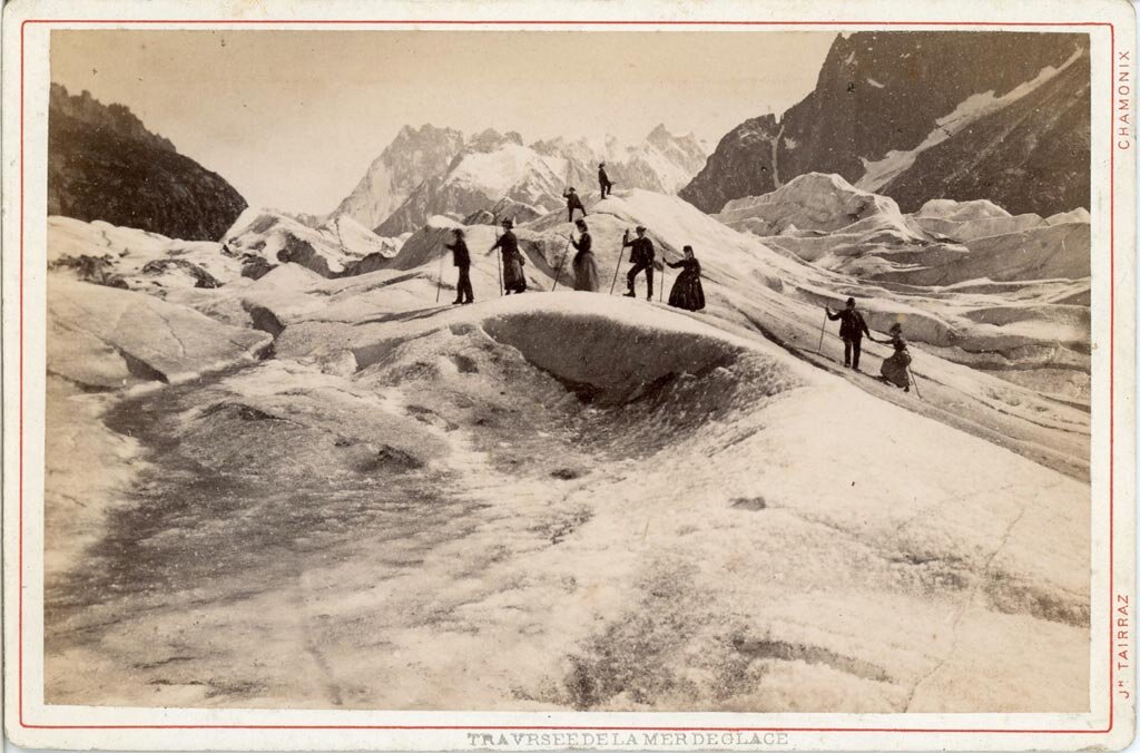
Joseph Tairraz, Traversée de la Mer de Glace, c.1870

Joseph Tairraz, Traversée de la Mer de Glace, c.1870

I love the nonchalance with which the climbing party seems to be strutting across the Mer de Glace. The people in this photograph would have held their poses for up to several minutes while Tairraz made the exposure, as the slight motion blur betrays. It’s a beautiful and, to contemporary viewers, quite strange image. We have no trouble relating to the activity and the motives underlying it. Alpine adventurism has grown from a fringe pursuit to a mainstream pastime since the 1870s. But the nature of the collective affectation is quite unfamiliar. Such is the artifice of it, the solemnity - as though somehow to compete with the grandeur of the mountain world around them

What’s also notable is the way the photograph signals a kind of ongoing democratisation. With the advent of photography, ordinary people could for the first time have their image immortalised. And it’s at least conceivable that the journey onto ice was made precisely for the picture. A picture which stands today as powerful testament to the entangled history of photography and Alpine tourism. What’s apparent from the visual record is that the medium played an important role in making and remaking popular perceptions of the Alps, as developments in the photographic process and shutter technology led to increasingly sophisticated and surprising ways of representing the mountains. Such representations, in turn, were instrumental to the Alps’ gradual reconceptualisation in the cultural imagination from hostile wilderness to favoured holiday destination.

For many centuries, the mountains were disdained for their chaos and desolation. Local folklore abounds with tales of dragons and malign spirits. But attitudes began to change in the second half of the nineteenth century as, spurred on by artists, philosophers and aestheticians, people developed a passion for wild places and the feeling of cosmic diminution that only they could inspire. Against the backdrop of Romanticism, photographers competed to produce ever-more spectacular panoramas from summits, outcrops and glaciers. And as their pictures diffused across the continent, the trickle of visitors to Switzerland became a tide. By the 1880s, facilitated by a growing railway network and a string of new hotels in valleys and foothills, the country was estimated to be receiving a million tourists per year.

Over the ensuing century, the Alps gradually emerged as the ‘playground of Europe’, a process which has found highest form, perhaps, in the ‘Step into the Void’ experience atop the Aiguille du Midi: a glass cube suspended above a thousand metre drop. Although this is a complex story that did not unfold through a series of neat and linear breakthroughs, its basic outline can be traced by focusing on a particular feature of the mountain landscape for which there was a craze during the 1860s: glaciers.

Something of the reverence for which mid-nineteenth century writers reserved for glaciers can be discerned from Karl Baedeker’s preface to his best-selling Handbook for Travellers to Switzerland (1863):

‘the Glacier is the most striking feature of the Alpine world, a stupendous mass of the purest azure ice. No aspect of Switzerland is so strikingly beautiful and at the same time so strangely beautiful.’

Simon Roberts, Berghaus Diavolezza #1, Bernina Massif, 2016

Simon Roberts, Berghaus Diavolezza #1, Bernina Massif, 2016

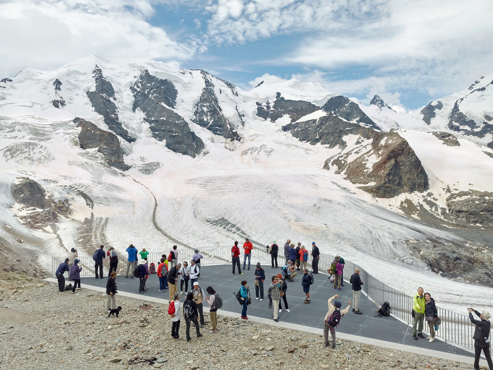
Jumping ahead almost one-hundred-and-fifty years to this image from Simon Roberts’ series Sight Sacralization, there is no mistaking the age of the hashtag. The Pers Glacier is an object to behold rather than to be negotiated, something to be had only in the cheapest, most fleeting sense. Clearly much has changed relative to the Tairraz: the permanent physical incursion, people’s clothes, their demeanour, not to mention the role of the photographer - one a facilitator, even participant; the other a spectator engaged in explicitly sociological work.

But in some ways Roberts’ photograph can be considered just a twenty-first century update. In both images, the glacier serves as a backdrop to a very human scene: people acting out the same basic impulse to somehow arrest the passage of time, only in ways distinct to their age. Both images provoke reflection on memory, communication, the will to conquer and control, and seen side-by-side, they testify to a profound shift.

For Ansel Adams, landscapes began at the point of human intervention - and so he always maintained his practice was not properly categorised: he was a photographer of the wild West, not of landscapes. For Adams, then, there would have been little doubt that this incongruous protrusion, a zone for selfies, negates the idea of wilderness that he and many other nineteenth-century photographers fought to protect.

John Ruskin, Frederick Crawley, Mer de Glace, Chamonix, 1854

John Ruskin, Frederick Crawley, Mer de Glace, Chamonix, 1854

This Daguerrotype is one of the earliest known photographs taken in the Alps. Its maker, John Ruskin, claimed to have made the first ‘sun-portrait’ of a Swiss peak, the Matterhorn, during one of his many trips to the range - where he would sketch, write and speculate on geological matters. In contrast to its quite lustrous appearance in the later Tairraz photograph, the Mer de Glace appears here as something fundamentally treacherous and unforgiving. The ice looks harsh and inflexible, almost as though made from alabaster.

William England, Mer de Glace, 1863/65

William England, Mer de Glace, 1863/65

The same hulking meander is seen at a greater remove in this photograph by William England, a photographer renowned in his day but now almost forgotten. It also shows the Mer de Glace towards the end of the Little Ice Age (c.16th to 19th centuries). But where Ruskin’s image is otherworldly and defamiliarising, England’s composition brings into focus the proximity of an altogether different world: there is an interesting tension between the pastoral and the unruly.

The photograph is fairly typical of England’s style. Unlike Ruskin, he seldom ventured far from tourist paths, choosing instead to emphasise scale through deft composition. Beginning in the early 1850s, wet-collodion photographers produced much more dramatic results of mountain scenes than could be achieved with Daguerreotypes. But the process was cumbersome: each glass negative had to be sensitised on site, and then quickly developed in a portable darkroom. It was a time-consuming enterprise whose results could not be profitably mass-produced.

Joseph Tairraz, Interieur de la Grotte, c.1865

Joseph Tairraz, Interieur de la Grotte, c.1865

This particular problem was overcome with the rise of stereography in the later 1850s, a technique by which two slightly different photographs of the same scene were combined. When viewed simultaneously through an apparatus of lenses and prisms, an illusion of three-dimensional depth was produced. The invention was a sensation, catering to the growing demand for affordable souvenirs and enabling those who couldn’t travel to experience exotic places from the comfort of their living room. And while traditional large-format photographers needed a whole entourage of porters to carry their equipment and chemicals (as in the famous photograph by August Rosalie Bisson), stereographers could manage everything they needed single-handedly.

Without such portability, it’s unlikely Tairraz could have brought back an impression of this glacial grotto, which conveys so well the translucent quality of ice, its sheen and luminescence. The foreground arch seems almost licked with flames.

Hotel Bären, Grindelwald, c.1890-1900The Library of Congress has acquired a huge archive of photochroms, many of which were made in the Alps. Although most depict the splendour of the wilderness, many also record the steady encroachment of tourist infrastructure. The luxurious Hotel Bären, seen here, was destroyed by fire in 1941.

Hotel Bären, Grindelwald, c.1890-1900

The Library of Congress has acquired a huge archive of photochroms, many of which were made in the Alps. Although most depict the splendour of the wilderness, many also record the steady encroachment of tourist infrastructure. The luxurious Hotel Bären, seen here, was destroyed by fire in 1941.

Stereography fell out of fashion with the simplification of the photographic process in the 1880s and the rise of the amateur photographer. But another fad was already starting to emerge. The next development brought colour to the Alps. With the invention of photochroms in the Swiss town of Nürensdorf, the distinctive Alpine palette could be approximated and combined with an indexical representation for the first time. Produced using a complex lithographic process which built directly on the experiments of Niépce with bitumen, photochroms were also primarily intended for the tourist market. As such, they were mostly anonymous, with attribution limited to the place of manufacture; in this case, Photoglob in Zürich.

Luigi Ghirri, Alto Adige (1972-75)

Luigi Ghirri, Alto Adige (1972-75)

Luigi Ghirri’s photograph of sightseers in South Tyrol seventy years later says much about the state of Alpine tourism without making it explicit. In a certain sense, the picture mediates between the Tairraz and the Robets. Ghirri captures his subjects candidly, from behind - they aren’t performing for camera but seem genuinely taken by the view. And yet it’s all too obvious they’ve been brought here by a coach or cable car, such is the inadequacy of their clothes for glacial traverses. We are not yet, however, at a point where it’s deemed necessary to install special observation decks.

Until relatively recently, glaciers seemed to all who saw like fluctuating but more or less unyielding wonders in a permanent wilderness. Their vulnerability is now all too apparent. If warming continues unabated, they are projected to have mostly disappeared from the Alps by the end of the century. Due to ice-albedo feedback, their demise will raise global temperatures even further. As much as glaciers are totemic of climate change, they are also defining features of the mountain wilderness. Once they are gone, along with most snow caps, the atmosphere of the place will be quite different. Instead of ice rivers protruding almost obscenely from misty heights into idyllic valleys, there will be a harsh and barren moraine more reminiscent of the Moon than paradise.

From Stefan Schlumpf, Hidden Landscapes

From Stefan Schlumpf, Hidden Landscapes

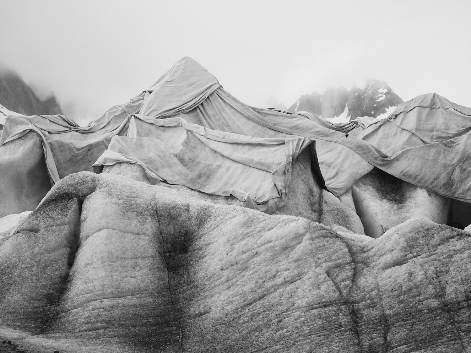
Such a future for the Alps seems increasingly unstoppable. But as Stefan Schlumpf’s series Hidden Landscape shows, authorities have not yet abandoned glaciers to their fate. At some of the most vulnerable, white blankets are now draped over the ice during summer months. With time, the folds, ridges and crevasses of the fabric become caught up in the glacier’s mostly imperceptible dynamism. And some of Schlumpf’s close-ups reveal a pleasing resonance between the topography of the ice and the material, which in turn has echoes of the peaks themselves. The series highlights in a simple but poignant way our powerlessness in the face of climate disaster. Schlumpf finds beauty in tragedy.

The Rhone Glacier, from Fabian Oefner, Timelines (2019-20)

With similar pathos, experimental photographer Fabian Oefner’s project Timelines visualises glacial retreat using the latest technology. Employing LED drones to trace out the contours of glacial footprints from previous years, the artist superimposed the results of a series of long exposures. Just as stereographs made the Alps palpable for people who were unlikely ever to visit, Oefner too seeks to make visible that which is abstract.

And it’s a fearful visualisation. The silky threads emanating from a still resilient glacier, an ice world withdrawing ineluctably into granite. But what is this image ultimately? A scientific record, a eulogy, a call to action? Work like this is often justified as raising awareness, jolting people into a deeper, more reflective form of consciousness. The magnificent work of Edward Burtynsky or Sebastião Salgado is emblematic. But since such heightened awareness usually only lasts for a short while, the degree to which this genre can go beyond pure aestheticization is dubious.

Like photographs, glaciers appear at first glance to be static, frozen. But as I have tried to show, their cultural meaning is always in flux, always mediated by new technologies and warped by commercial incentives. Since both the age and beauty of these places are hard to grasp conceptually, photography, from Daguerrotypes to drone flyovers, has provided a way of reaching for a certain fixity.

Almost two-hundred years have passed since the invention of the medium, an age in human history but utterly insignificant in geological time. Almost everything is now different compared to when Ruskin first stepped out onto the Mer de Glace with his wooden camera. With increasing intensity, people have dynamited passes and excavated tunnels, erected observation platforms and strung up networks of ski lifts. But for the mountains, there is basically complete continuity.

And yet while the idea of deep time is evasive, and impossible to convey, in itself, in a photograph, what can be discerned quite clearly from the juxtaposition of images stretching back to the medium’s origin is an ongoing domestication of the Alps whose final destination is always deferred, always just beyond the horizon.

The system of surfaces

‘It’s not often we come down here, Professor, so you’ll have to excuse the disorder.’

The archivist reached into his overcoat and pulled out a key. Fumbling with a heavy padlock for a few moments, he tugged open the door and groped around for the switch. Overheads flickered into life, revealing a large rectangular room. The concrete walls were streaked with algae; in the centre was a shallow, sloping pit.

‘The old swimming pool’, said the archivist. ‘Most of this is overflow, we’re in the process of organising it properly...’

He scurried down the steps with an agility that took the Professor by surprise. She followed cautiously, casting her eyes over broken mosaic floors and racks of vintage hardware. The archivist glanced down at a scrawl on his palm.

‘It’s at the end of Aisle 7, if you wouldn’t mind waiting a moment.’

He strode off into the gloom, returning a short while later with a slim folder, whose contents he laid carefully on a table. The Professor examined each print successively, turning them over in her hands and studying the surfaces with a pocket magnifying glass.

‘And you don’t know when they were captured exactly?’, she asked, without looking up.

‘We can only speculate. But the consensus is late 22nd century.’

‘And there’s no attribution, no indication of purpose?’

‘Nothing we can detect using present technology.’ The archivist paused for a moment. ‘Possibly someone sensed what was coming and wanted to preserve some part of the virtual. We know there were these all-encompassing networks, satellite images assembled into a sort of navigable alternate reality – by some accounts almost indistinguishable from the real thing. Very little evidence of them survived the Blackout, of course, just the odd artefact like this.’

The Professor’s brow twitched. ‘I can understand the jump to conclusions - they’re very alluring, quite unlike anything I’ve seen. And yet...’ Her finger traced some outlines. ‘These settlements...you must have considered how organic they look – unplanned and informal?’

The archivist forced a smile. ‘You know I’ve never understood the assumption that Martian settlements would look somehow rationally planned. People here believe colonisation was this rigidly controlled enterprise that would inevitably result in grids of domes, or a concentrically zoned hub. But they forget this was a frontier. It’s entirely possible that development proceeded after a time in a quite haphazard way.’

As he was speaking, the Professor returned the prints to their folder and pulled off her gloves. ‘Thank you for showing me these, Mr Volkov. They make for an intriguing sequence.’
She stood up.

‘A few years ago, I headed up the cataloguing operation for a large discovery made in the Unincorporated Territories - a bunker. It was mostly perfunctory, inventories and the like. But there was something quite unexpected: prints, similar in size to these – and remarkably well preserved. They showed great industrial cities from above - at least a few million people each. Far too big for us to have no record. But there was none. We never identified them.’

She made a move for the stairs, before turning around.

‘Forgive me, but it strikes me that if you genuinely believed they were Mars, you’d make them public.’

The archivist chuckled.

‘You know as well as I do, Professor, that if rumour of an undarkened civilisation got out, there’d be hysteria and revolt. Think of it, with us all living underground...and on a near neighbour. We’d have to explain the silence.’

And with that, he picked up the folder and withdrew once more into the gloom of Aisle 7, humming something softly under his breath.

All images generated by the ‘This City Does Not Exist’ Generative Adversarial Network by Ron Hagensieker and Tomas Langer.